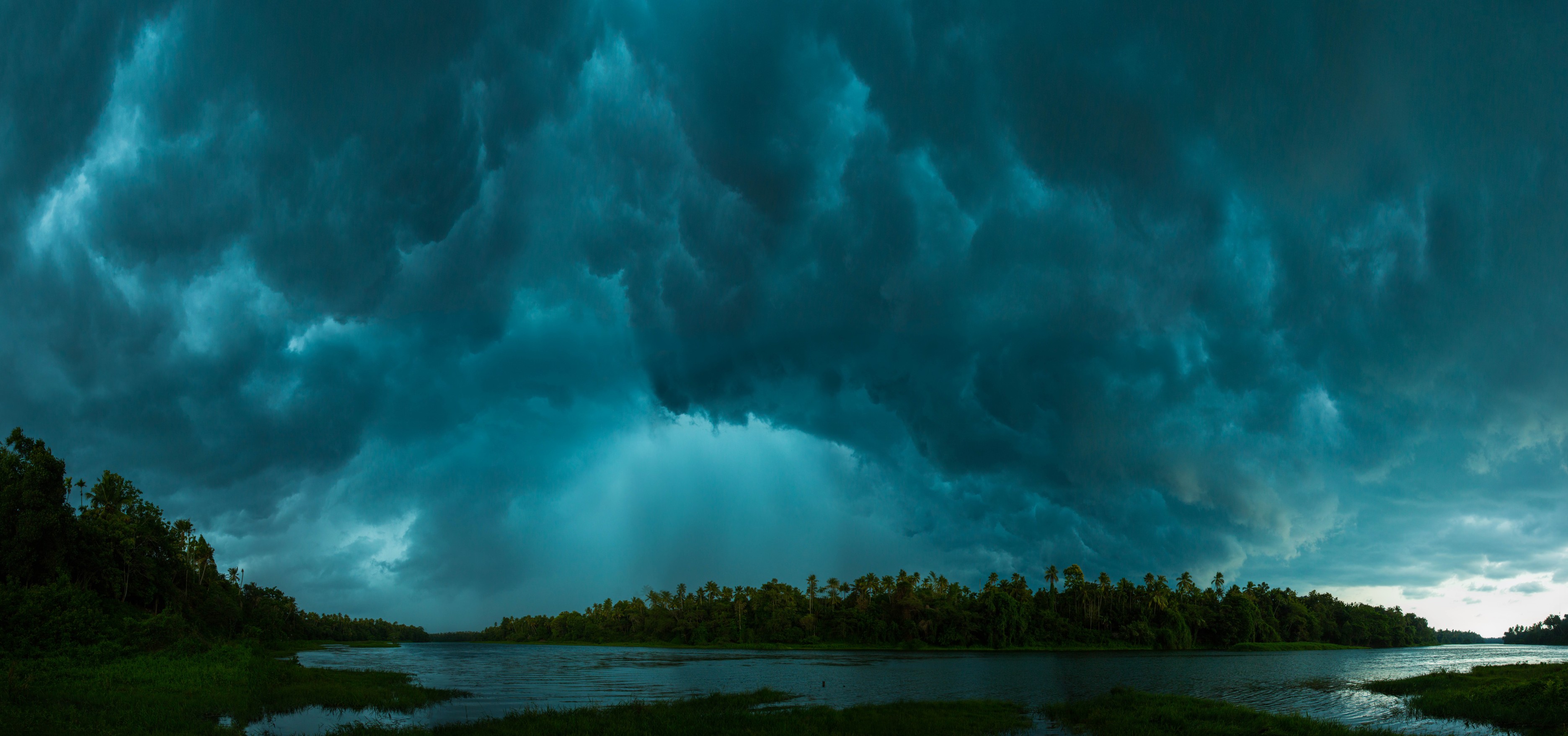
It is that time of the year when we keep a close eye on weather forecasts, tracking the monsoon’s progress across the country, as it brings relief from the scorching summer heat. Weather is deeply intertwined with society, influencing agriculture, water resources, extreme events and health risks.
But predicting weather can be extremely challenging. Climate scientists piece together diverse sources of data from satellites, weather stations, historical records, and even observations made by ordinary citizens. To model complex atmospheric processes, they use traditional physics-based simulations and newer artificial intelligence tools trained on large datasets. Even as global warming alters the climate system, scientists are assessing how well today’s weather models will perform in the future.
At the Indian Institute of Technology Hyderabad, researchers are developing methods to understand weather patterns across scales, from rainwater inflow into rivers to predicting extreme events in urban localities. They are collaborating with government agencies and policymakers to ensure that research findings reach communities who need them the most and at the right time.
Satellites, sensors and citizens
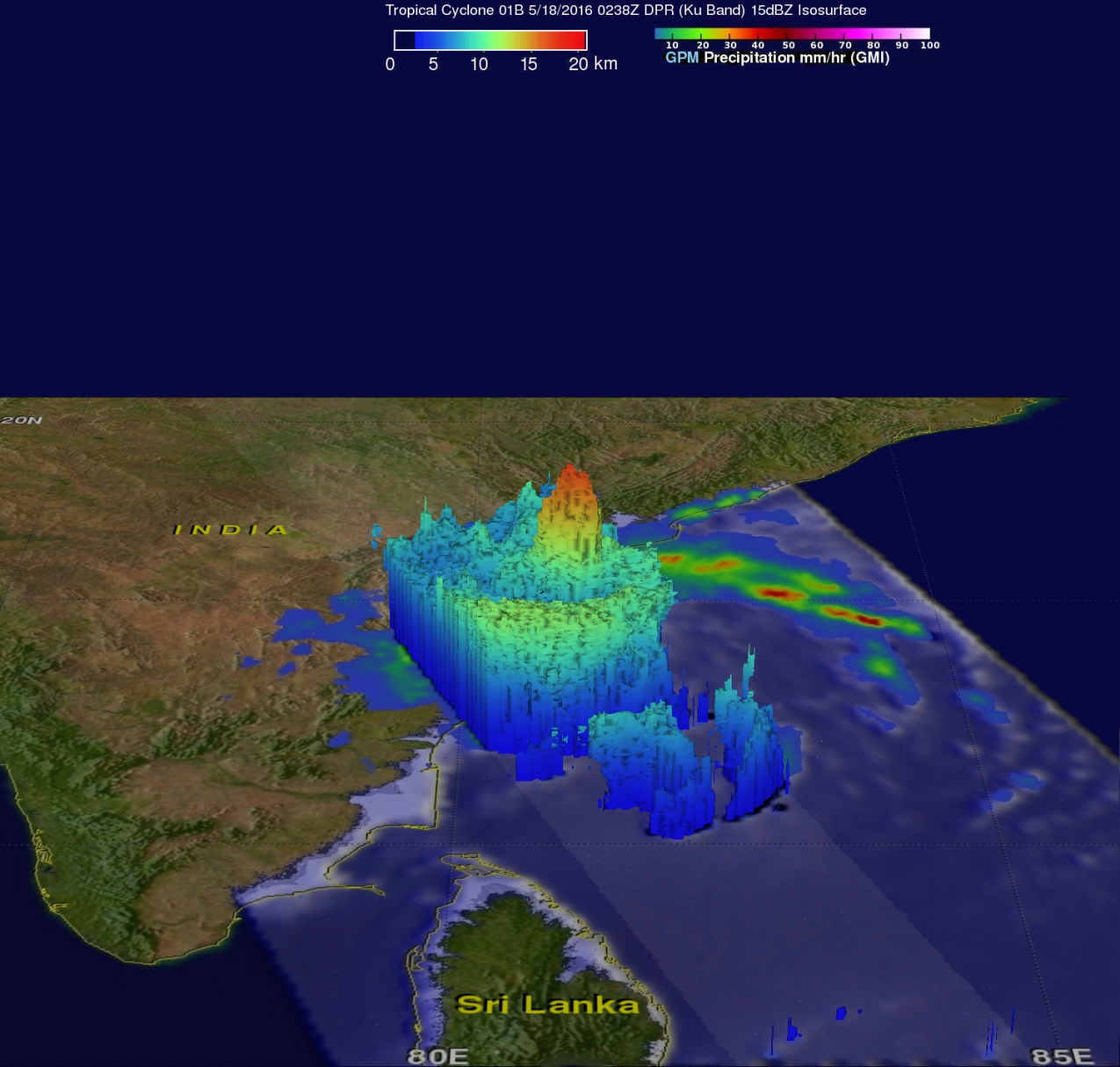
“Too much or too little of precipitation is a challenge,” says Dr Shruti Upadhyaya, a faculty in the Department of Civil Engineering (CE), who uses satellite data and on-ground measurements to understand rainfall and its extremes. “If you look at the Indian context, which is driven by agriculture, having low rainfall has a strong impact. At the same time, with a growing population and denser cities, a lot of rainfall in a short span of time leads to floods,” she explains.
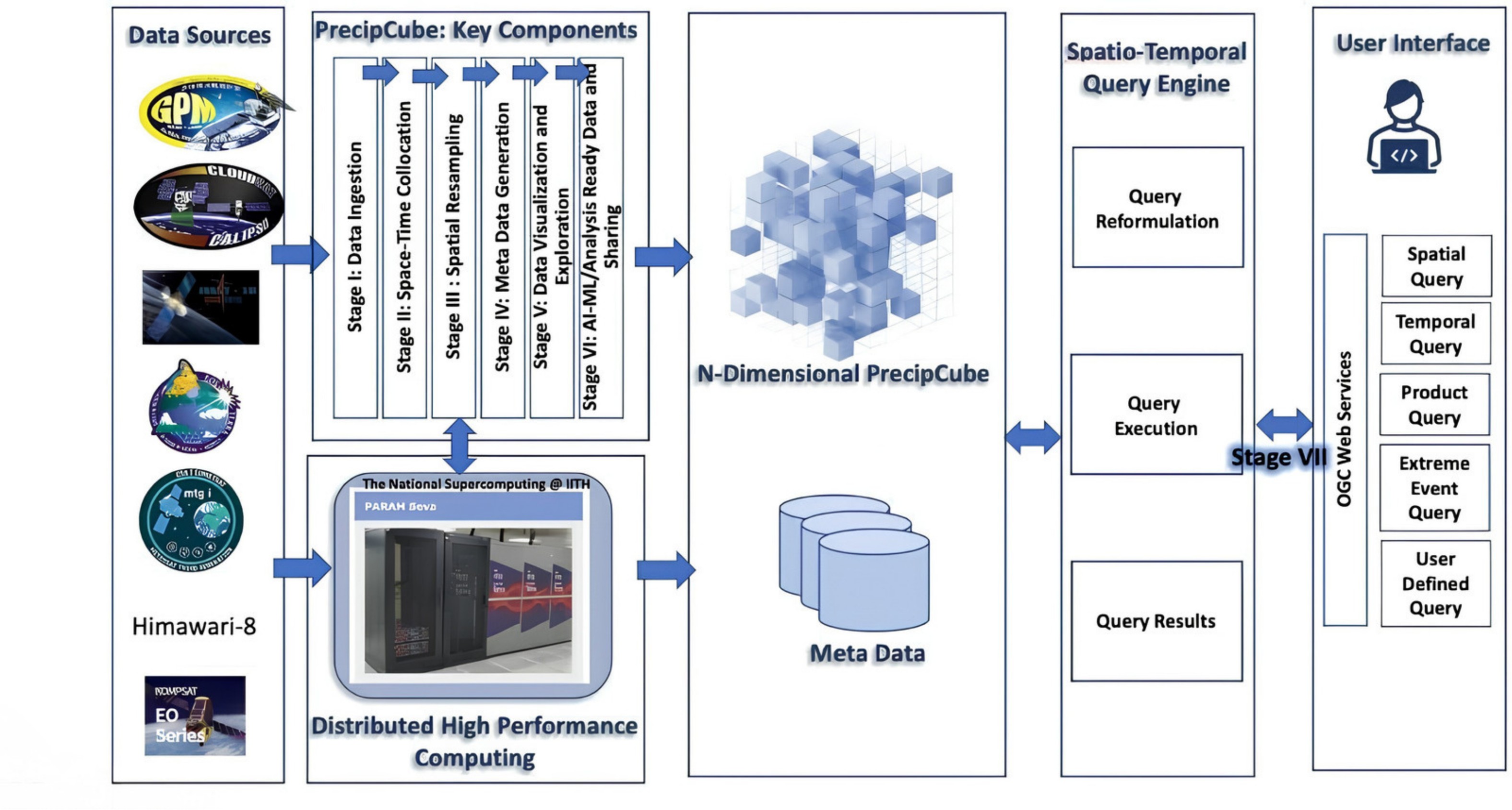
Climate scientists are piecing together data from satellites, weather stations, historical records, and crowdsourced observations to study weather.
Her research group is interested in nowcasting, where weather predictions are made at a hyperlocal scale, a few hours in advance. She is also collaborating with computer scientists to assemble a single searchable database that integrates multiple sources of rainfall data. Her group’s broader goal is to develop reliable data-driven weather models that can be deployed operationally.
In recent work, Dr Shruti’s group trained a deep learning model using integrated precipitation data from multiple satellites to accurately predict rainfall over northern India, half an hour in advance. In other research, her group used a machine learning model to create accurate and easy-to-read flood susceptibility maps for two localities fed by Brahmaputra and its tributaries that can be used by local stakeholders for decision-making.
Despite having a smaller footprint, weather patterns in cities can vary widely in space and time, making predictions challenging.
Nowcasting is also of interest to Dr Satish Regonda, a faculty member in CE who studies flooding at the dual scales of expansive river basins and densely packed cities. His group is working on estimating rainfall a few hours in advance by integrating information from weather models, radar, satellites and ground observations. “Forecasting for the smaller spatial scale is not necessarily easy,” he says. Even though cities have a smaller footprint, weather patterns can vary widely in space and time, making predictions challenging. “Since the population in a city is denser, one needs to pay attention to spatial variability and obtain information at finer temporal intervals,” he adds.
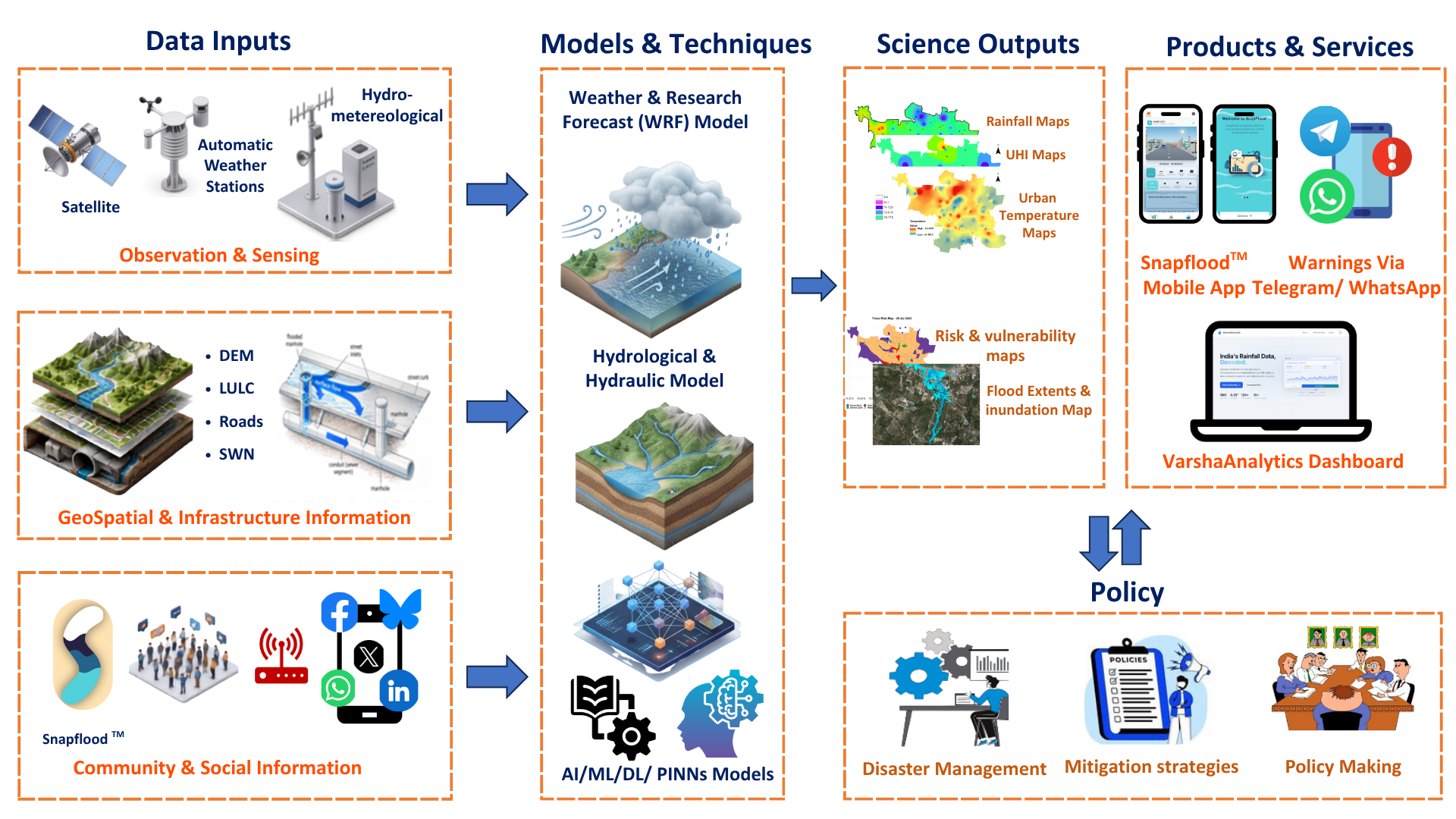
“Over the last few years, we have been developing an Urban Flood Information System for Hyderabad,” using satellite data, on-ground measurements and data contributed by citizens. Such crowdsourced data allow for better spatial coverage of inundation and offer complementary information for flood models. In a recent study, Dr Satish’s group used social media posts to obtain fine-scale information on location and severity of rainfall in Hyderabad. They combined it with rainfall and elevation data to create a flood impact score for the city. More recently, they expanded their analysis to 63 urban areas across India, looking at how rainfall patterns have changed over the last 120 years.
His group is developing rainfall nowcasting and flood information products tailored to the needs of different stakeholders. Their work combines science, engineering and policy, for relaying accurate weather predictions to decision makers for effective flood preparedness and response.
Analysing extreme rainfall events from the past can help us understand their triggers and evolution, improving weather forecast systems.
Not just data from the present, but events from the past can help scientists predict weather. “One of my students is working on preparing a catalogue of extreme events from the past, trying to understand what has driven them,” says Dr Maheswaran Rathinasamy, a faculty in CE whose research is at the intersection of hydrology and atmospheric processes. “This can help us understand their atmospheric triggers and how they gain moisture, which can help us develop a better forecast system.”
Extreme rainfall events arise from processes interacting across spatial and temporal scales. Dr Maheswaran’s team combined a statistical method to study rare and severe events with a cross-scale measure of weather extremity to tell apart local transient events from widespread, long-lived rainfall extremes.
This is one example of his group’s broad interest in devising methods to understand climatic processes that interact across local and regional scales. A theme running across their research is understanding the links between precipitation and surface water, from localised extreme events to the flow of rainwater through a river basin.
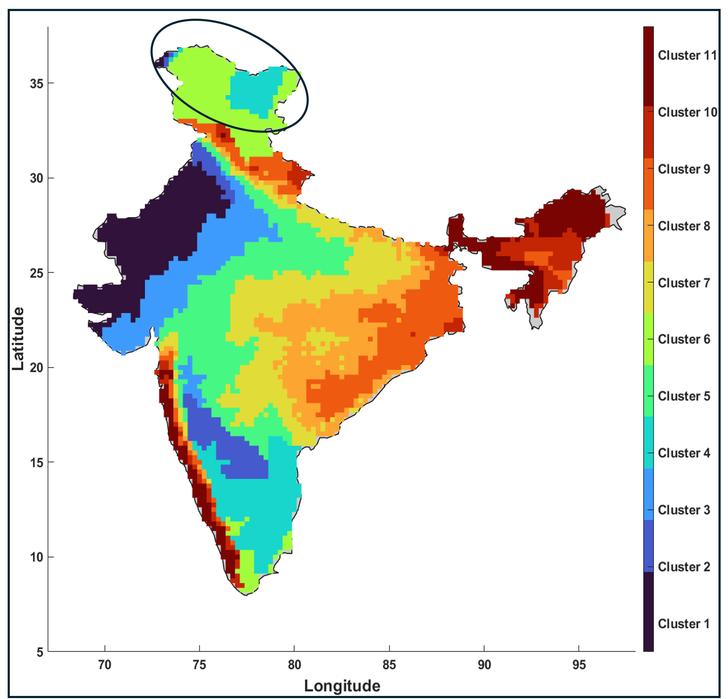
Using daily rainfall data, the team has developed a robust framework that classifies the Indian subcontinent into eleven distinct regions based on rainfall amount and variability. They also identified areas showing significant change in rainfall patterns in these regions over the last seven decades.
Cogs and wheels
“We can look at historical records to see how many times a cyclone has occurred in the past, say in a coastal village along the Bay of Bengal,” says Dr Anamitra Saha, a faculty member in the Department of Climate Change, who studies climate risk. “Even if a cyclone has never crossed the village, we cannot say that its probability is zero. There is still some chance.”
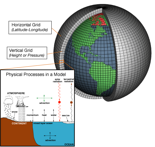
To estimate this probability, climate scientists have traditionally relied on climate models, which are computer simulations based on the laws of physics. In these models, a region of interest is divided into spatial grids, in which mathematical equations describe how variables such as temperature, pressure and humidity evolve over a series of time steps. Models at a finer resolution in space and time can make more accurate predictions, but have a higher computational cost. “We need to run these models many many times, because the reality is just one realization of several possibilities,” says Dr Anamitra. This quickly becomes computationally expensive.
Newer physics-guided, data-driven models are enabling faster weather forecasting, helping in timely risk assessment and response.
Data-driven techniques, such as artificial intelligence and machine learning (AI/ML), are much faster at high-resolution weather forecasting and climate modeling. However, they were originally developed for computer vision and natural language processing, and we do not fully understand how they make climate predictions, explains Dr Anamitra. These models can be unreliable when used as black-box models, especially in climate scenarios they haven’t encountered before, adds Dr Shruti.
An important aspect of Dr Anamitra’s research is developing physics-guided machine learning models tailored for climate prediction. He uses data-driven methods to improve the resolution of climate models, so that they are useful in local decision-making. In previous work, Dr Anamitra and colleagues improved the resolution of a climate model several-fold using these data-driven methods informed by simple physics. They suggested that a combined physics-guided, data-driven approach is likely the most promising path forward, rather than using them in isolation. This can help in faster localised risk assessments, which can be crucial when responding to extreme events.
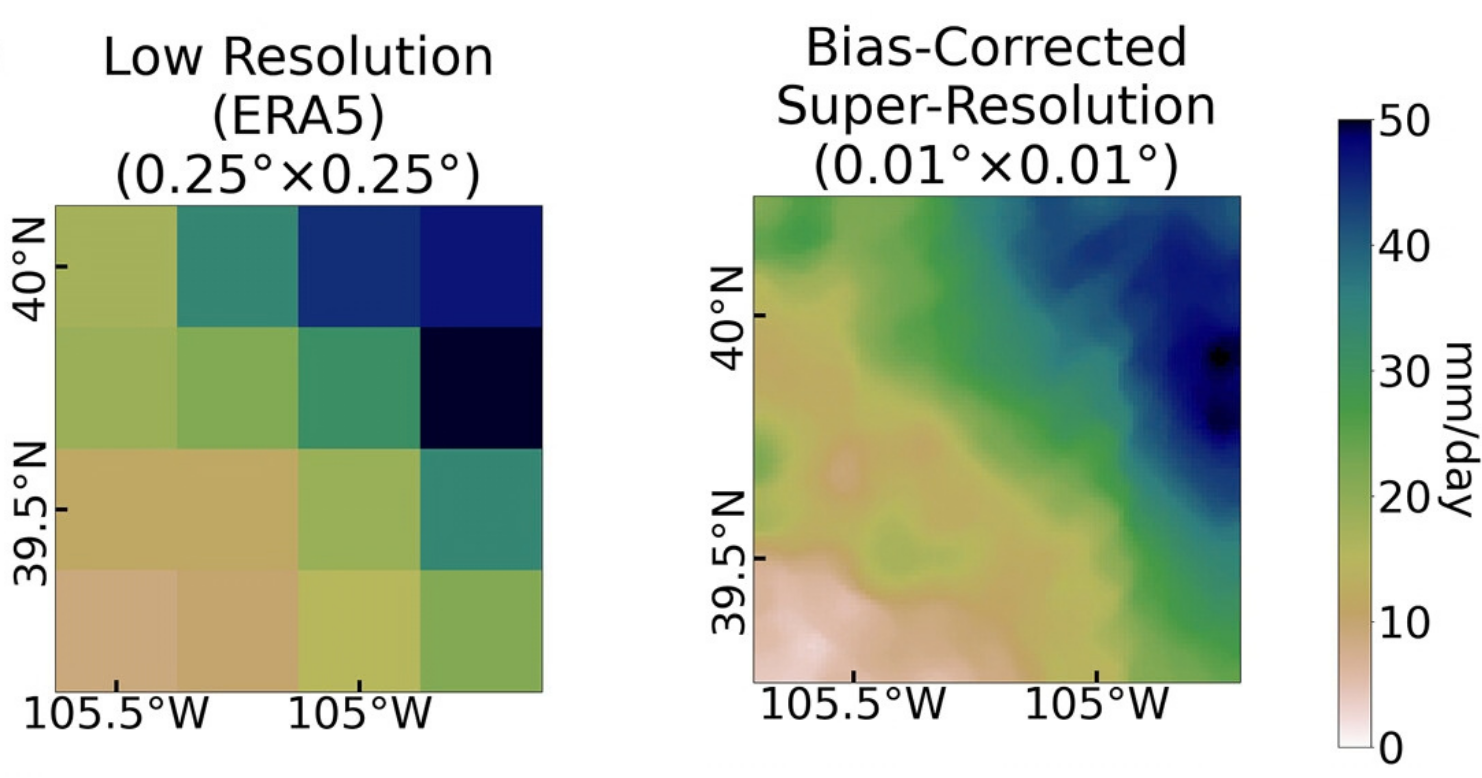
Dr Shruti advocates for using explainable methods to evaluate AI/ML models, which makes it easier for decision-makers to understand how good a model’s predictions are, enabling them to make informed decisions.
However, any model is as good as its input data. When data is scarce, researchers use inventive workarounds. For example, flood forecasting relies heavily on water level measurements from gauges installed across a river basin. “However, there are many locations where we do not have any data,” says Dr Maheswaran. His group is developing a framework to more accurately predict streamflow in such data-poor areas. Based on similarities in geography and climate with more well-studied catchments, it identifies suitable hydrological models that can inform reservoir operation.
In the absence of models to borrow, proxies can be useful. “To understand urban floods, we need detailed information about a city’s drainage network, and its functionality,” says Dr Anamitra, which is difficult to obtain. During his postdoctoral research, he turned to the unlikely source of insurance claims data to study the relationship between rainfall and flooding. They trained multiple machine learning models using two decades of insurance data, corrected them for biases, and evaluated their performance in predicting the risk of flood-related losses.
Despite progress with better data and models, scientists still grapple with the complexity of climate. Urban areas present a unique challenge, where buildings, vegetation, water bodies and energy interact to influence local weather systems. Dr Satish and his team’s analysis of data from automatic weather stations across Hyderabad reveals differences in rainfall patterns between older parts of the city and the suburbs, suggesting that urbanization may influence local weather patterns.
Another overarching challenge that scientists are trying to address is related to how well the weather models of today will perform in a rapidly warming world.
Lessons from the distant past
“A major failure of climate models is that they are hypertuned to modern climate,” says Dr Chetankumar Jalihal, a faculty from the Department of Climate Change who studies the monsoon’s evolution over tens of thousands of years. “Global warming has been pushing the monsoon system into uncharted territory, making it difficult to predict how it might change in the next two to three decades.” Studying the impact of ancient global warming can help us understand what could happen in the future, he adds.
Global warming is pushing the monsoon system into uncharted territory. Studying paleoclimate can help us understand what could happen in the future.
One can test whether climate models perform well under novel conditions by using them to recreate the climate of the past. Furthermore, Dr Chetan’s research uses simulations of paleoclimate (climate in ancient periods), as a “test bench for monsoon theories.” If our understanding of the physics behind the monsoon is correct, these theories should be able to explain the monsoons of the past. When they fail, it offers an opportunity to refine them. “This helps us arrive at more generalised and comprehensive laws.” A focus of his research is a simple relationship involving energy and water vapour in the atmosphere that is able to reconstruct the natural variability of the monsoon over thousands of years.
In recent work, he studied the effects of reversing the Earth’s rotation on the monsoon. While it was earlier thought that the reflection of sunlight by the bright sand of the Sahara was a key limiting factor of the monsoon, their model revealed that reversing Earth’s spin changes the flow of water vapour. This has a more important effect on the atmospheric energy balance, causing a monsoon to develop over the desert. Over longer timescales where cyclical changes in the Earth’s orbit influence climate, his research finds that the monsoon over the land and ocean can become decoupled because the energetic processes that drive them are influenced differently.
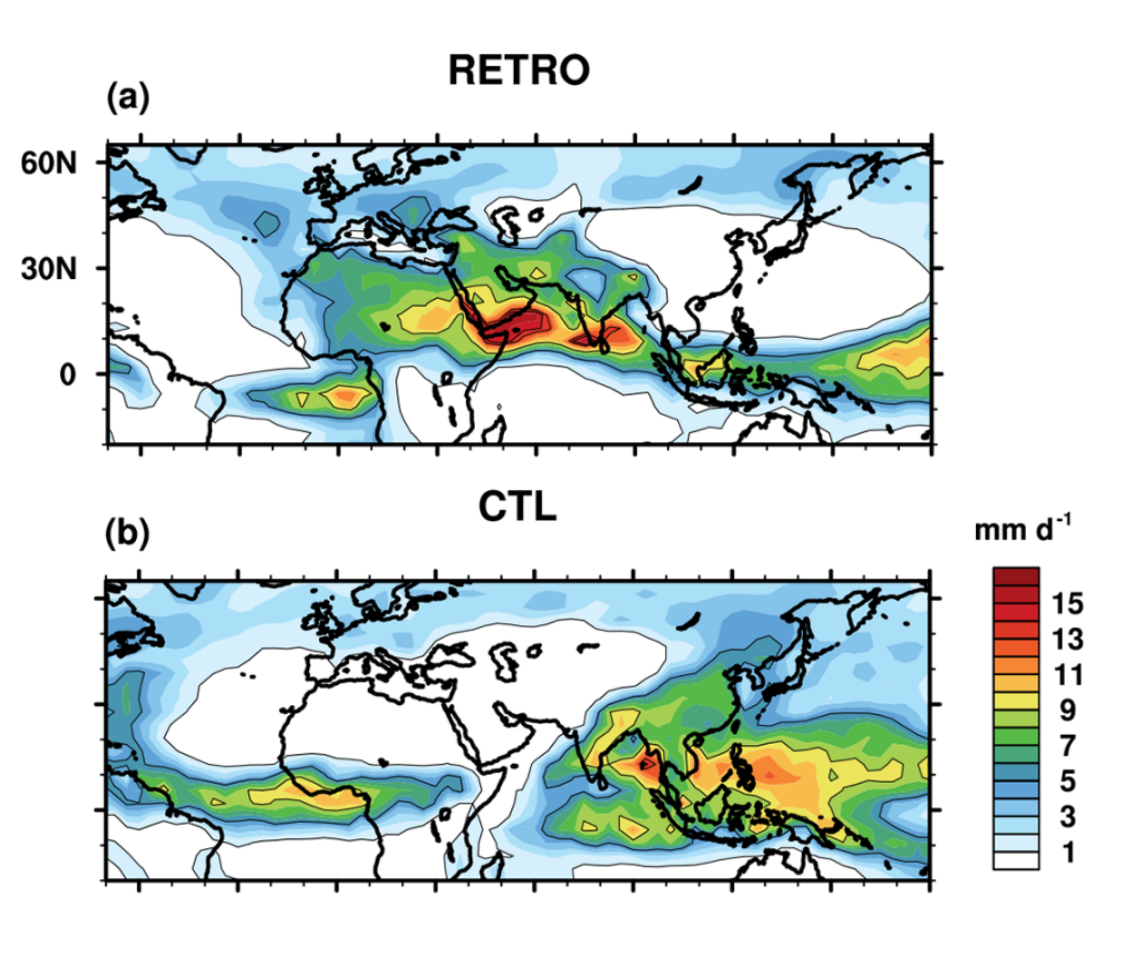
“I’ve begun to realise that theories based on the energy budget are better at explaining the monsoon, from the ice age to the present, and even into the future,” says Dr Chetan.
It takes a village
Climate emerges from interconnected processes spanning space and time that transcend administrative boundaries. Studying it requires international cooperation to launch satellite missions and share ground-based observations. As part of the International Precipitation Working Group, Dr Shruti and other scientists advise the World Meteorological Organization, a United Nations agency, to identify gaps and promote data sharing.
Climate change is a multidimensional challenge. Weather predictions are effective when they reach the last mile and serve those most vulnerable to climate risk.
This has contributed to a global improvement in weather forecasting by helping researchers build better weather models. Scientists are also exchanging information with government agencies and local authorities to make informed decisions. “If these predictions don’t reach the last mile, they are not going to be effective,” says Dr Satish, whose group works with municipal corporations and disaster management agencies for effective flood management in cities. At the watershed scale, Dr Maheswaran’s group is developing models to improve rainfall predictions under Mission Mausam, an initiative by the Ministry of Earth Sciences to enhance weather forecasting.
Climate change is a multidimensional challenge and tackling it needs people from diverse backgrounds to work together, says Dr Anamitra. He emphasises the need for collaboration between climate scientists and social scientists to serve the people most vulnerable to the risks of climate change. It is also important to find effective ways of communicating complex climate projections, to make them accessible to the general public.
As global warming changes weather patterns, researchers across disciplines are working together to improve weather and climate predictions and communicate this information to the communities most impacted by them.